Underground Utilities and What Changed in 2026
Most cities grow first and fix their infrastructure later. Dholera was built the other way around.
Before the first factory gate opened, the Dholera road network and its underground utility corridor were already laid out across the activation area. A grid of asphalt, ducts and reserved right-of-way, waiting for the city to arrive.
That sequencing is the single most important thing to understand about Dholera Special Investment Region.
Here is what the road and utility layer actually consists of, and where it stands in 2026.
72 km of Roads, Built to a Plan
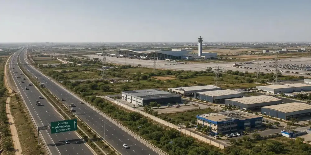
The internal road network across Dholera’s activation area spans roughly 72 kilometres. Carriageways range from 18 metres to 70 metres wide.
The variation is deliberate. Wide arterial spines carry heavy industrial and long-distance traffic. Mid-tier collector roads distribute it into sectors. Narrower access roads serve individual plots.
Anyone who has driven through an unplanned industrial belt knows why this matters. Container trucks and two-wheelers end up sharing the same eight-metre lane, and the bottleneck never gets fixed because there is no land left to widen into.
Dholera’s grid reserves that land upfront. The right-of-way exists whether or not the traffic does yet.
The roads are also built for what comes later. Junctions are signalised, lighting is installed along completed stretches, and the geometry accommodates future volumes rather than current ones.
Which is why photographs of Dholera often show impressively wide, largely empty roads. At this stage, that emptiness is the point.
The Underground Utility Corridor
The more consequential piece of engineering sits below the surface.
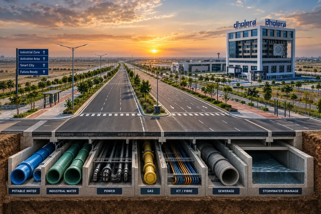
Running alongside the roads is a dedicated underground utility corridor — a continuous system of ducts and services carrying potable water, industrial water, gas, power cables and ICT fibre, along with drainage and sewerage lines.
Three practical consequences follow.
No overhead clutter. No poles, no sagging cable spans, no transformers on footpaths. It is a visible difference the moment you enter the developed sectors.
No repeated road cutting. In a conventional Indian city, a new fibre line or a water main repair means digging up a road that was resurfaced six months earlier. Dholera’s corridor is accessible for maintenance and expansion without tearing the carriageway apart.
Plot-ready connections. Trunk services already run past every serviced plot. A company acquiring land is not waiting on a separate utility extension project — water, power and data terminate at the plot boundary.
All of it is coordinated from Dholera’s central command and control facility, which monitors utilities, traffic and city systems from a single point. That is the “smart” component with some substance behind it.
Designed for People, Not Just Trucks
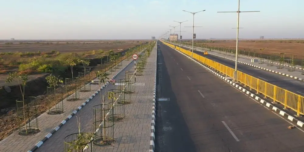
The Dholera road network is not purely an industrial logistics grid.
Each corridor cross-section includes pedestrian walkways, dedicated cycling lanes, landscaped plantation strips, and a reserved central corridor for future rapid transit.
That last element deserves attention. Reserving transit right-of-way inside the road cross-section before development happens is unusual in India.
It is also precisely what makes retrofits so expensive elsewhere. Metro and BRT projects in established cities spend years and enormous sums acquiring land or going elevated, because no corridor was ever set aside.
Dholera has kept that strip vacant from day one. A mass transit line can be laid without demolition or acquisition when demand justifies it.
The plantations follow similar long-horizon logic — shade, dust suppression and stormwater absorption on a coastal plain that gets hot and flat.
How the Internal Grid Connects Outward
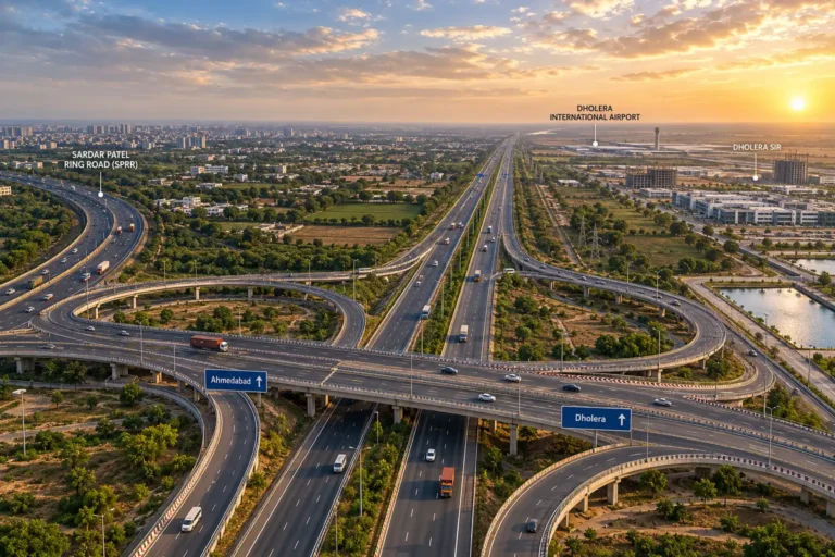
Internal roads are only as useful as their external links. In 2026, those links firmed up considerably.
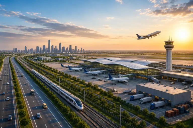
Expressway. The Ahmedabad–Dholera Expressway is now operational, cutting the journey from Ahmedabad to roughly 45 minutes to an hour.
Airport. Dholera International Airport has crossed 80% completion. The runway, taxiways and ATC tower are finished and the terminal building is well advanced, with operations targeted for the second half of 2026.
Rail. In May 2026, the Union Cabinet approved a semi-high-speed rail link to Ahmedabad worth around ₹20,667 crore.
Funding for the internal layer continued alongside. The Gujarat Budget 2026-27 allocated ₹610 crore for Phase 1 of the Logistics and Trunk Infrastructure Project at Dholera SIR, covering roads, drainage, utilities and airport-supporting infrastructure.
A separate proposal of around ₹650 crore covers a bulk water pipeline network — critical for semiconductor and electronics manufacturing.
Why the Road Layer Matters Commercially
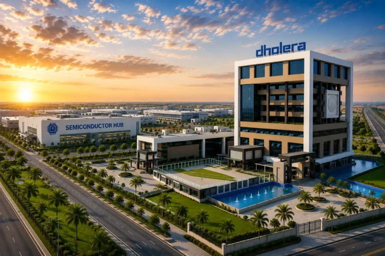
Dholera’s industrial pitch is anchored by Tata Electronics’ semiconductor fabrication plant and a growing electronics ecosystem. That pitch depends entirely on this groundwork.
Fabs are among the most infrastructure-hungry facilities in manufacturing. They need ultrapure water at volume, uninterrupted power, high-capacity data links and reliable heavy-vehicle access.
A fab cannot wait three years for a utility corridor to be dug.
For land buyers and developers, the road network functions as a reliability signal. Announcements can be revised. Laid asphalt, buried ducts and energised substations cannot be un-built.
Serviced, plot-ready land inside a completed grid behaves differently from raw land near a proposal.
None of which makes Dholera a short-term play. It remains a long-gestation project where timelines shift, and anyone evaluating it should treat official announcements and quarterly progress updates as the reference point rather than promotional material.
The Takeaway
Seventy-two kilometres of graded, serviced roads with utilities running beneath them is not a headline-grabbing statistic next to a ₹91,000 crore fab or an international airport.
But it is the layer everything else sits on.
Dholera’s bet is that a city built grid-first will absorb growth without the retrofitting bill that every other Indian industrial hub is still paying.
Frequently Asked Questions
Roughly 72 km across the activation area, with road widths ranging from 18 metres to 70 metres depending on their role in the hierarchy.
A dedicated underground corridor running alongside the roads, carrying water, gas, power, ICT fibre, drainage and sewerage — eliminating overhead lines and repeated road excavation.
Yes. Each corridor reserves a central strip for future rapid transit, alongside pedestrian walkways, cycling lanes and plantation strips.
Yes. It is operational and reduces travel time from Ahmedabad to roughly 45 minutes to an hour.
Construction crossed 80% completion in 2026, with the runway and ATC tower finished. Operations have been targeted for the second half of 2026, subject to DGCA licensing.